Province of Cavite
THE PROVINCE OF CAVITE
The province of Cavite is located in the southwestern part of Luzon. It is hemmed at the south
and southwest by Batangas, at the east and northeast by Laguna, and at the west and northwest by
Manila Bay. The province received its name from the Tagalog word “Kawit,” meaning fish hook,
which is descriptive of the fish hook-like formation of the peninsula extending from the present
day Kawit to the present-day Cavite City.
Topographically, Cavite is divided into two parts. The highland area is composed of the towns of
Dasmariñas, Carmona, Gen. Mariano Alvarez, Silang, Amadeo, Mendez, Indang, Alfonso, Bailen,
Magallanes, Tagaytay City, Trece Martires, and a certain portion of Maragondon and Gen. Trias.
On the other hand, the lowland area is made up of Bacoor, Imus, Kawit, Noveleta, Cavite City,
Rosario, Tanza, Gen. Trias, Maragondon, and Ternate. It has a total land area of 316,581
hectares. According to the latest statistics, the population of Cavite is about 1,901,231 with a
Catholic population of 1,565,235. Evidences of early human settlement in Cavite date back to
Paleolithic Period. Archeological findings like barkcloth beaters were found in Tagaytay near
the Taal Vista Lodge, now Taal Vista Hotel. There were also data that show that there was a
thriving community in what is now Barrio Pangil located between Amadeo and Indang. This
community approximately dates back to the 14th Century. Silang and Bacoor were believed to be
inhabited by Borneans. It is believed that these people landed on Cavite’s shore in 1212 AD.
There are documents which point to Bornean traders and Islamic missionaries who stayed in Manila
and its environs as having spread Islam. According to Luther Parker, “It seems likely that
Cavite Viejo is the oldest town of Cavite province, and that from this point the Borneans spread
over the province by the water routes at first.”
Varieties of porcelain ware of the Ming Dynasty period were recovered in areas such as Ternate
and Sangley Point, which regularly served as the sampan landing sites of the tip of the Cavite
Peninsula. In 1571, Miguel Lopez de Legaspi ordered Martin de Goiti to start the initial
conquest of Luzon. The Spaniards under Martin de Goiti landed in Cavite, and they found out that
it was sparsely populated. The natives were found to be quite friendly to the foreigners. In
1582, a report written by Miguel de Loarca mentioned the coastal towns of Vacol (Bacoor),
Minacayan (Binakayan, now a barrio of Kawit) and Maragondon. From Cavite Viejo (Kawit), the
Spaniards proceeded in their exploration and found a small native settlement at the end of the
hook which was then known as Tangway. Eventually, this settlement would be transformed into a
walled Spanish port town, which would be called Cavite Puerto. In 1614, Cavite was proclaimed as
a politico military province with Cavite Puerto as the capital.
By the 17th Century (after half a century of Spanish occupation) Tangway or Cavite Puerto had
become a town with stone houses, cobbled streets, light churches, a fort and stone walls that
curtained the Intramuros from the bay. Cavite was the Spanish idea of a perfect port for
absolute maritime world power, the harbor and haven for the world’s greatest armadas, an
imperial seaport. Gone forever was the spit of sand where children used to swim and fish.
Cavite had also become the oriental terminal of the fabled galleon line to, the colony’s life
line “of silver and friars.” In the port, galleons stacked Chinese silk, brocades, damask,
velvet, pearl, and rubies – all the fabulous treasures of the East. The galleons ferried back
from Mexico millions of pesos in silver, soldiers, and missionaries; every year, the national
budget balance on the waves of the Pacific.
As a result of this profitable trade, there was an influx of people to the Puerto. There, the
“multitude, variety, and confusion of languages, people, and nation,” mingled in informal
camaraderie. People from nearby provinces settled as shipyard workmen and seamen. By 1616,
Cavite Puerto was described as “a port where men of all nations assembled for the sake of
commerce which is remarkable…as the largest one in the Philippine Islands after the said
metropolis (Manila)…” the oidor, Don Francisco Leandro de Viana, considered Cavite as “la llave
de Manila” (the key to Manila); the second capital of the Philippines. “Of what use would Manila
be without Cavite?

“By the 17th Century (after half a century of Spanish occupation) Tangway or Cavite Puerto had become a town with stone houses, cobbled streets, light churches, a fort and stone walls that curtained the Intramuros from the bay. Cavite was the Spanish idea of a perfect port for absolute maritime world power, the harbor and haven for the world’s greatest armadas, an imperial seaport. Gone forever was the spit of sand where children used to swim and fish."
.jpg)
1750's view of Cavite (Painting)
.jpg)
Cavite Circa 1750's (Whole Map)
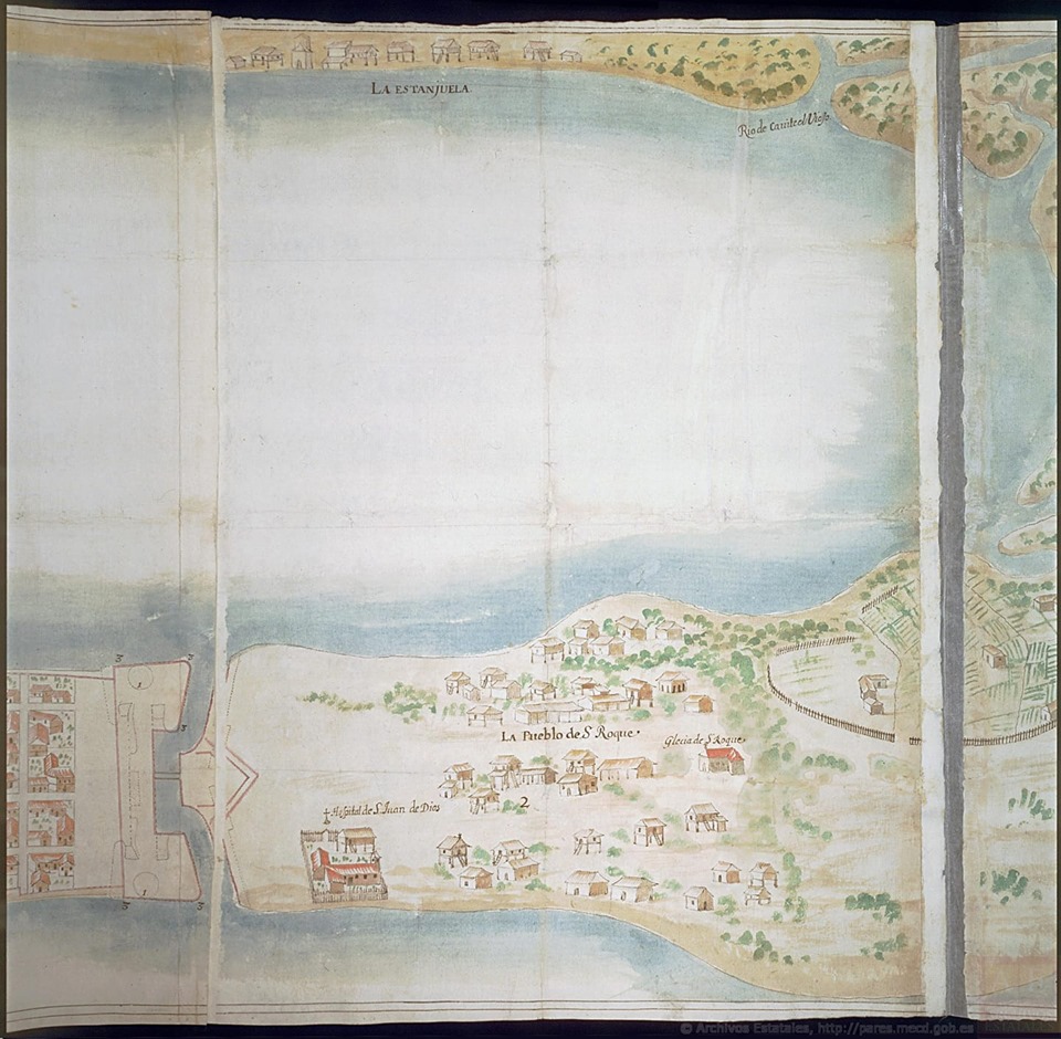
Cavite Circa 1750's
.jpg)
Painting of Ermita de Porta Vaga Church and Porta Vaga (Gate)
.jpg)
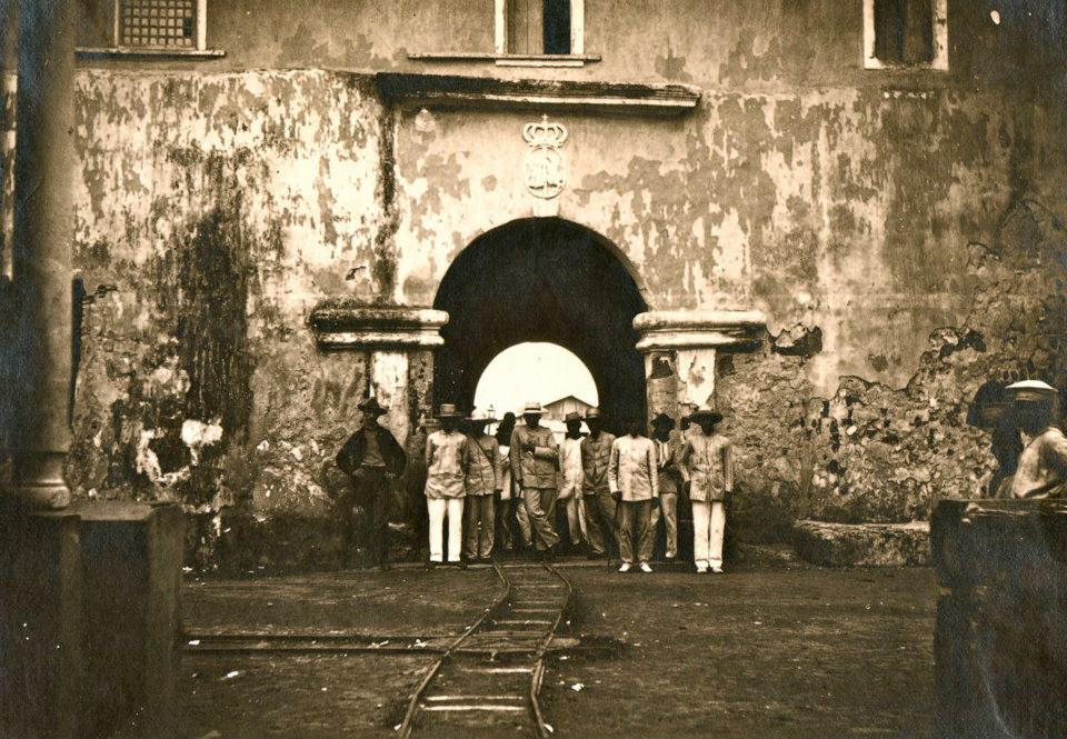
Porta Vaga (Gate)

Porta Vaga Gate
-
1750's view of Cavite (Painting)
-
Cavite Circa 1750's (Whole Map)
-
Cavite Circa 1750's
-
Painting of Ermita de Porta Vaga Church and Porta Vaga (Gate)
-
Porta Vaga (Gate)
-
Porta Vaga Gate